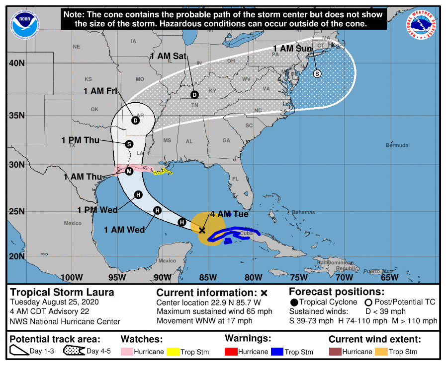
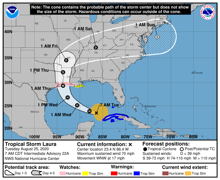
Tropical Storm Laura 7 AM Track Update
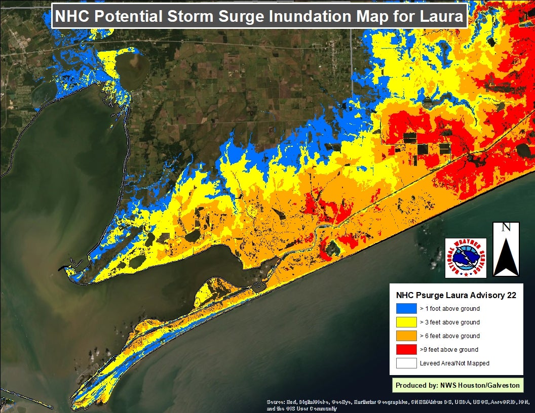
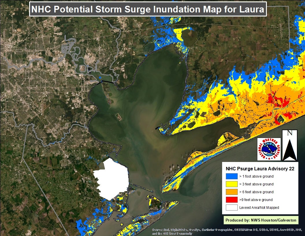
Regional and zoomed in updated inundation graphics/images attached from the 4a advisory track
LAURA NOW FORECAST TO BECOME A MAJOR HURRICANE OVER THE NORTHWESTERN GULF OF MEXICO WEDNESDAY
VERY DANGEROUS HURRICANE LAURA FORECAST TO MAKE LANDFALL ON THE UPPER TX COAST OR FAR SOUTHWEST LOUISIANA
HURRICANE, STORM SURGE AND TROPICAL STORM WATCHES REMAIN UNCHANGED FROM 4 am FORECAST
SUMMARY OF 700 AM CDT...1200 UTC...INFORMATION
Location: 23.4N 86.4W, or about 145 mi NW of Cuba
Maximum sustained winds:.75 mph
Motion: WNW at 17 mph
Pressure: 991 mb and falling
Do not hesitate to call the office if you have questions or concerns.
Look for more updates throughout the day.
Resources
- NWS Houston Galveston Phone Numbers: (281) 337-5074 ext. 234 or ext. 232
- NWS Houston/Galveston Webpage: www.weather.gov/houston
- National Hurricane Center Webpage: www.hurricanes.gov
- Hourly Forecasts (Click Your Location): http://forecast.weather.gov/gridpoint.php?site=hgx&TypeDefault=graphical
- West Gulf River Forecast Center Webpage: www.weather.gov/wgrfc
- AHPS Webpage: http://water.weather.gov/ahps2/index.php?wfo=hgx
If you have any additional questions, please feel free to contact our office at the phone numbers listed in the Resources section above.
National Weather Service - Houston/Galveston, TX
Twitter: @NWSHouston
Facebook: NWSHouston