

Crisis Management is monitoring the weather. Here is the most recent update:
Bottom Line
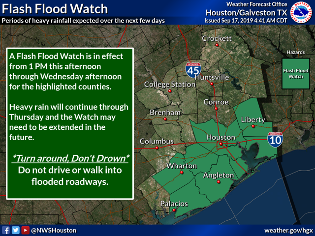
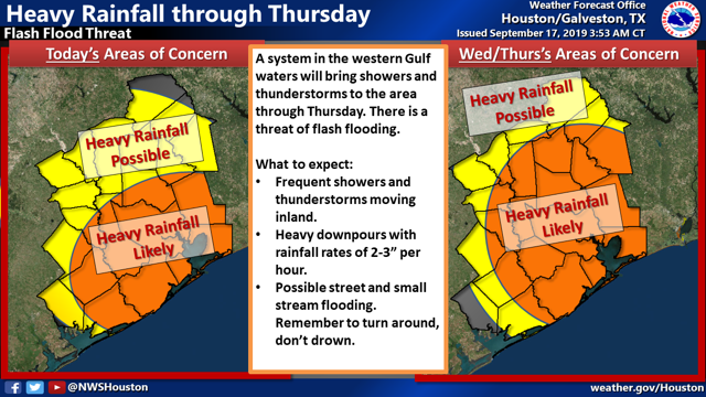
Showers and thunderstorms will gradually move inland today and areas near the coast could receive periods of heavy rain today. A Flash Flood Watch is in effect starting at 1 PM this afternoon for areas along and south of a Wharton to Houston to Cleveland line.
Overview
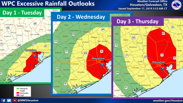
A coastal trough, deep tropical moisture and an upper level low pressure system will produce periods of showers and thunderstorms today through Wednesday. Some of the rain will be heavy at times. Widespread rainfall in the Watch area will average between 1 and 3 inches by Wednesday morning with isolated areas receiving 4 -6 inches of rain if training of storms develops. Additional rainfall is expected on Wednesday into Wednesday night with another 2 to 4 inches of rain possible with again some higher isolated totals.
Alternate Possibilities
Confidence is fairly high that today's rain event will be mainly near the coast and Galveston Bay and the amounts forecast should be representative of what falls. But confidence in additional rainfall Wednesday and Wednesday night is a bit lower. Several models deepen low pressure over the Gulf and keep this feature offshore. The rain would then be focused rather narrowly on the coast and over the Gulf. The low and associated rainfall would then move into southwest Louisiana Wednesday night.
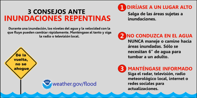
Urban Flash Flood Messaging
Heavy rainfall is forecast for portions of Southeast Texas, including highly urbanized areas like the Houston metropolitan area. Based on forecast conditions, NWS Houston will be utilizing the following urban flash flood messaging for this event:
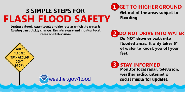
"Turn Around, Don't Drown" Flash Flooding (Select if Anticipating High Rainfall Rates; 2-4"/hour)
- Turn Around, Don't Drown. Isolated underpasses or low-water crossings may be life-threatening.
- Monitor the NWS, your local media, HCFCD and other official weather information sources.
Resources
- NWS Houston Galveston Phone Numbers: (281) 337-5074 ext. 234 or ext. 232
- NWS Houston/Galveston Webpage: www.weather.gov/houston
- National Hurricane Center Webpage: www.hurricanes.gov
- Hourly Forecasts (Click Your Location): http://forecast.weather.gov/gridpoint.php?site=hgx&TypeDefault=graphical
- West Gulf River Forecast Center Webpage: www.weather.gov/wgrfc
- AHPS Webpage: http://water.weather.gov/ahps2/index.php?wfo=hgx