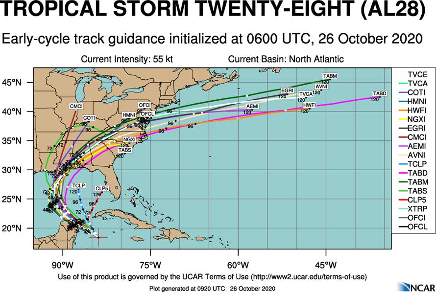
Oct. 26 - Tropical Storm Zeta Advisory
SUMMARY OF 800 AM:
LOCATION...18.9N 84.8W ABOUT 175 MI...285 KM SE OF COZUMEL MEXICO MAXIMUM SUSTAINED WINDS...70 MPH...110 KM/H PRESENT MOVEMENT...NW OR 315 DEGREES AT 9 MPH...15 KM/H MINIMUM CENTRAL PRESSURE...992 MB...29.29 INCHES
WATCHES AND WARNINGS:
CHANGES WITH THIS ADVISORY: None
SUMMARY OF WATCHES AND WARNINGS IN EFFECT:
A Hurricane Warning is in effect for:
- Tulum to Dzilam Mexico
- Cozumel
A Tropical Storm Warning is in effect for:
- Pinar del Rio
- Cuba South of Tulum to Punta Allen
- West of Dzilam to Progreso
A Hurricane Warning means that hurricane conditions are expected somewhere within the warning area. A warning is typically issued 36 hours before the anticipated first occurrence of tropical-storm-force winds, conditions that make outside preparations difficult or dangerous. Preparations to protect life and property should be rushed to completion.
A Tropical Storm Warning means that tropical storm conditions are expected somewhere within the warning area within 36 hours.
Watches will likely be required for a portion of the northern Gulf Coast later today.
For storm information specific to your area, please monitor products issued by your national meteorological service.
DISCUSSION AND OUTLOOK:
At 800 AM EDT (1200 UTC), the center of Tropical Storm Zeta was located by a NOAA Hurricane Hunter aircraft near latitude 18.9 North, longitude 84.8 West. Zeta is moving toward the northwest near 9 mph (15 km/h). A northwestward motion with an increase in forward speed is expected over the next day or so, followed by a turn toward the north Tuesday night. A faster northward to north-northeastward motion is forecast on Wednesday. On the forecast track, the center of Zeta will move near or over the northern Yucatan Peninsula later today or tonight, move over the southern Gulf of Mexico on Tuesday, and approach the northern Gulf Coast on Wednesday.
Observations from a NOAA Hurricane Hunter aircraft indicate that maximum sustained winds are near 70 mph (110 km/h) with higher gusts. Strengthening is forecast, and Zeta is expected to become a hurricane later this morning. Additional strengthening is expected before Zeta moves over the Yucatan Peninsula.
Tropical-storm-force winds extend outward up to 115 miles (185 km) from the center.
The latest minimum central pressure reported by a NOAA Hurricane Hunter aircraft data is 992 mb (29.29 inches).

