Feb. 13 - Winter Storm Watch Weather Advisory
From the National Weather Service
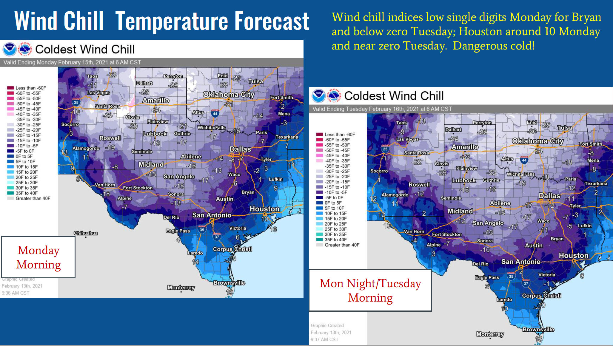
Frigid, life and property threatening winter weather is expected into Thursday, with most severe conditions Sunday night into Tuesday
- Bitterly cold air will continue moving into the region into midweek as an Arctic air mass spills into the area. Prolonged periods of below-freezing temperatures are expected - even at the beaches.
- Two weather systems (one Sunday night-Monday morning and another toward midweek) will produce winter precipitation across many parts of Southeast Texas.
- Travel will be impacted by hazardous road conditions. Sporadic power outages will be a possibility where ice builds up on powerlines and/or trees. Pipes (including sprinkler systems) will be subject to bursting if not adequately insulated, and hypothermia may be a possibility for those exposed and not dressed accordingly.
- Residents complete should complete preparations before the coldest air and widespread frozen precipitation begins arriving Sunday evening. Remember the Four P`s: pipes, people, pets, and plants. In addition, be aware of space heater and generator dangers if not properly placed/used.
- A period of moderate snow, sleet and freezing rain is expected Sunday night and Monday for all areas followed by bitterly cold conditions Monday night and Tuesday. Snow, ice and cold will likely pose a threat to life and property with hazardous road conditions, burst pipes and water manes, damage to infrastructure and at power outages. Risk of hypothermia for anyone outside who is not dressed properly.
- Today and Sunday, temperatures will be mainly near or just below freezing for areas north and west of Houston. Periods of freezing rain or drizzle expected, especially tonight and Sunday creating icy conditions there. Might include far W and NW Harris.
- Now is the time to insulate pipes, make plans to avoid travel and shelter indoors, especially for the Sunday night through Tuesday morning time frame.
- Another winter storm possible on Wednesday although could be more rain for southern zones. Still an ice threat, especially northern zones. Plenty of uncertainty still with that storm.